Skip to content
Pakistan Stratigraphy
Geoheritage of Pakistan

Where Pakistan wears its geology

Type sections and fossil beds, glaciers and mud volcanoes, a continental suture and a snowball-Earth boulder bed — 27 places where the rock record surfaces at its most legible.

27

geosites

14

provinces

7

in protected areas

39

linked units

Explore on the map

Tap a marker for the site and the unit it exposes.

Loading map…
Distinctive erosional/structural landform or scenery Type or reference section of a named unit Notable fossil or trace-fossil locality Fault, suture or tectonic-boundary exposure Mine or economic-geology site Glacier or glaciogenic feature Stratigraphic boundary / global correlation section Active geological process (mud volcano, seismicity) Coastal / island geosite Exposed Precambrian basement / shield

Browse the geosites

27 sites

Salt Range 6

Province →
Precambrian

Khewra Salt Mine

Mine or economic-geology site

also Mayo Salt Mine

One of the world's oldest and largest rock-salt mines, worked into the Ediacaran–Early Cambrian Salt Range Formation at the eastern end of the Salt Range. The mine exposes the halite–gypsum–marl evaporite sequence that also forms the basal décollement of the Salt Range–Potwar fold-and-thrust belt.

  • Halite with up to ten potassic layers; the type region of the Salt Range Formation
  • The evaporites are the regional seal and the basal thrust detachment of the Potwar Plateau
  • Major public tourist attraction (illuminated chambers, a brine 'lake' and salt-brick architecture)
ScientificEconomicCulturalScenic
Cenozoic

Makarwal Coalfield

Mine or economic-geology site

also Makarwal–Kalabagh coalfield

One of Pakistan’s historic coalfields, worked into the basal Paleocene Hangu Formation of the Trans-Indus Surghar Range, where carbonaceous shales and coal seams overlie the eroded Cretaceous surface.

  • Coal seams in the transgressive Paleocene Hangu Formation
  • Long-worked Trans-Indus (Surghar–Makarwal) coalfield
  • Records the earliest Cenozoic marine flooding of the basin
EconomicScientific

Exposes

Quarrying Details →
Cenozoic

Nammal Gorge & Lake

Type or reference section of a named unit

also Nammal Nala

A scenic gorge and reservoir in the western Salt Range cut through the Paleocene–Eocene succession, and the type locality of the Nammal Formation. The Patala–Nammal–Sakesar interval here records the first Palaeogene marine transgression and carries the region's main hydrocarbon source rocks.

  • Type section of the Nammal Formation
  • Nummulitic Sakesar Limestone forms the gorge cliffs
  • Patala/Nammal shales are the primary Potwar petroleum source rocks
ScientificEducationalScenic
Palaeozoic

Nilawahan Gorge — Tobra Formation glacial tillite

Type or reference section of a named unit

also Warcha–Nilawahan section

Exposures of the Early Permian Tobra Formation preserve glacial tillite and glacio-marine diamictite deposited when the Indian plate lay near the South Pole on the margin of Gondwana — the Salt Range record of the late Palaeozoic Gondwanan glaciation, correlative with the Talchir boulder beds of India.

  • Gondwanan glacial diamictite with striated, faceted clasts
  • Base of the Nilawahan Group; overlies the Cambrian across a major hiatus
  • Also a producing oil reservoir in the subsurface Potwar Basin
ScientificEducational

Exposes

Stable Details →
Precambrian

Salt Range Escarpment (Khewra–Choa Saidan Shah)

Distinctive erosional/structural landform or scenery

also Salt Range front

The south-facing escarpment of the Salt Range exposes an almost complete Cambrian-to-Eocene section in a single traverse — from the Precambrian–Cambrian Salt Range Formation up through Permian Gondwanan and Tethyan strata to Paleogene carbonates — recording the drift of the Indian plate from Gondwana onto the Tethyan margin.

  • Classic Cambrian → Permian (Nilawahan/Zaluch) → Paleogene traverse
  • Frontal thrust of the Salt Range–Potwar belt, detached on the Salt Range Formation evaporites
  • Iconic red-and-white banded hillsides
ScientificEducationalScenic
Palaeozoic

Zaluch Nala — Permian–Triassic boundary section

Stratigraphic boundary / global correlation section

also Chhidru–Mianwali boundary section · Nammal–Zaluch section

The western Salt Range holds one of the world's most complete shallow-marine Permian–Triassic boundary successions, where the fossil-rich Late Permian Chhidru Formation passes up into the Early Triassic Mianwali Formation across the end-Permian mass-extinction interval — a section studied internationally for the greatest biotic crisis in Earth history.

  • Type areas of the Chhidru and Mianwali formations
  • Continuous marine record across the end-Permian extinction
  • Rich Permian brachiopod, bryozoan and conodont faunas
ScientificEducational

Potwar Basin 1

Province →
Mesozoic

Kala Chitta Range

Distinctive erosional/structural landform or scenery

also Kala Chitta hills

A narrow east–west range north of the Potwar Plateau exposing a near-complete Jurassic-to-Palaeogene Tethyan shelf succession — Samana Suk carbonates, glauconitic Chichali shales and Kawagarh limestones — in a single, accessible thrust belt.

  • Jurassic Samana Suk to Cretaceous Kawagarh shelf section
  • Classic Kala Chitta–Margalla thrust belt
  • A much-studied teaching transect near Attock
ScientificEducationalScenic

Hazara Basin 3

Province →
Cenozoic

Margalla Hills nummulitic limestone

Distinctive erosional/structural landform or scenery

also Margalla Hills National Park

The forested ridge overlooking Islamabad is built of Eocene Margalla Hill Limestone and Chorgali Formation carbonates packed with Nummulites and other larger foraminifera — an accessible Palaeogene shallow-marine section within a national park at the capital's edge.

  • Eocene Nummulites and Assilina in roadside outcrops
  • Part of the Kala Chitta–Margalla thrust belt
  • Within Margalla Hills National Park
ScientificEducationalScenic
Palaeozoic

Sirban Hill (Abbottabad Formation)

Type or reference section of a named unit

also Sirban Maira

Sirban Hill above Abbottabad is the type area of the Cambrian Abbottabad Formation, a dolomite–sandstone–phosphate–chert succession correlated with the Krol Group of India and the Doushantuo Formation of South China, and host to the region's phosphate deposits.

  • Type area of the Abbottabad Formation
  • Neoproterozoic–Cambrian carbonate-phosphate platform
  • Economic phosphate horizons
ScientificEducational
Quarrying Details →
Precambrian

Tanaki Boulder Bed — Marinoan glaciation

Notable fossil or trace-fossil locality

also Tanakki Boulder Bed

A glaciogenic diamictite in the Hazara hills marking the terminal-Neoproterozoic Marinoan 'snowball Earth' glaciation (~605–595 Ma). Its striated, angular clasts and matrix support are correlated with the Blaini Formation of India and the Sinian diamictites of South China.

  • Local record of a global Neoproterozoic ice age
  • Marker horizon between the Tanawal and Abbottabad formations
  • Evidence for the palaeogeographic link between Lesser Himalaya and South China
ScientificEducational

Sulaiman Fold Belt 1

Province →
Cenozoic

Bolan Pass

Distinctive erosional/structural landform or scenery

also Bolan Gorge

The historic Bolan Pass cuts through the Paleocene–Eocene of the Kalat–Sulaiman front, exposing the Dungan Formation limestones and the overlying Ghazij Group red beds along a gateway used for millennia between the Indus plains and the Iranian plateau.

  • Paleocene Dungan limestone → Eocene Ghazij clastics section
  • A natural structural gateway through the fold belt
  • Long-standing trade and railway route
ScientificScenicCultural

Kirthar Range 2

Province →
Cenozoic

Kirthar Range & National Park

Distinctive erosional/structural landform or scenery

also Kirthar Hills

The Kirthar Range is the type region of the Eocene Kirthar Formation, thick nummulitic limestones forming the arid ranges west of the Indus. The southern Kirthar lies within Kirthar National Park, one of Pakistan's oldest and largest national parks.

  • Type region of the middle-Eocene Kirthar Formation
  • Nummulitic shelf carbonates of the Indus foreland
  • Kirthar National Park (Sindh ibex, urial)
ScientificScenic
Mesozoic

Pab Range

Type or reference section of a named unit

also Pab Nala type area

The Pab Range is the type area of the Maastrichtian Pab Sandstone — thick shallow-marine to deltaic quartz sandstones marking the top of the Cretaceous in the Kirthar–Sulaiman region and an important regional reservoir sandstone.

  • Type section of the latest-Cretaceous Pab Sandstone
  • Shallow-marine to deltaic quartz arenites
  • A key hydrocarbon reservoir of the Lower Indus Basin
ScientificEducational

Exposes

Stable Details →

Sindh Province 1

Province →
Cenozoic

Ranikot Fort & Ranikot Group type area

Type or reference section of a named unit

also Great Wall of Sindh

The largest fort in the world by circumference wraps around the eroded hills of the Paleocene Ranikot Group type area, where the Khadro, Bara and Lakhra formations record the earliest Cenozoic marine transgression over the Deccan-related volcanics of the Indus basin.

  • Type area of the Paleocene Ranikot Group
  • Records the Deccan-volcanism-to-marine transition (Khadro–Bara–Lakhra)
  • The ~30 km 'Great Wall of Sindh' fort walls follow the ridges
CulturalScientificScenic

Chagai Hills 1

Province →
Cenozoic

Koh-i-Sultan Volcano

Fault, suture or tectonic-boundary exposure

also Kuh-e Sultan

A deeply eroded Neogene–Quaternary stratovolcano of the Chagai magmatic arc in far-western Balochistan, built above the northward subduction of the Arabian plate; the arc hosts the giant Reko Diq porphyry copper–gold system.

  • Youngest volcano of the Chagai subduction-related arc
  • Andesitic–dacitic edifice with fumarolic sulphur deposits
  • Arc setting of the Reko Diq porphyry Cu–Au deposit
ScientificScenicEconomic

Makran Coast 2

Province →
Cenozoic

Astola Island

Coastal / island geosite

also Jazira Haft Talar · Satadip

Pakistan's largest offshore island, an uplifted table of Miocene–Pliocene Makran strata rising ~80 m from the Arabian Sea. Its wave-cut cliffs and terraces record the rapid coastal uplift of the Makran accretionary margin; it is a designated Marine Protected Area.

  • Uplifted Makran Group sediments forming a mesa-like island
  • Marine terraces recording coastal tectonic uplift
  • Pakistan's first Marine Protected Area (nesting turtles, seabirds)
ScenicScientific
Cenozoic

Chandragup Mud Volcanoes & Hingol

Active geological process (mud volcano, seismicity)

also Chandragup · Hinglaj mud volcanoes

Active mud volcanoes on the Makran accretionary prism, where methane and mud vent from the deforming Miocene–Pliocene Makran Group. Chandragup is a Hindu pilgrimage site on the route to Hinglaj, within Hingol National Park.

  • Active mud volcanism above the Makran subduction zone
  • Fed by dewatering of the Parkini/Talar (Makran Group) mudrocks
  • Sacred site on the Hinglaj Yatra; within Hingol National Park
ScientificScenicCultural

Zhob-Muslim Bagh 1

Province →
Cenozoic

Ziarat & the Nisai Limestone

Distinctive erosional/structural landform or scenery

also Ziarat juniper tract

The uplands around Ziarat expose the Eocene Nisai Limestone of the Zhob–Muslim Bagh belt and carry one of the world’s largest and oldest juniper forests, a striking pairing of Palaeogene shelf carbonate and ancient woodland.

  • Eocene Nisai Limestone shelf carbonates
  • Among the largest juniper (Juniperus excelsa) tracts on Earth
  • Set within the ophiolite-bearing Zhob belt
ScientificScenic

Exposes

Stable Details →

Kohistan Arc 1

Province →
Mesozoic

Main Mantle Thrust & Jijal Complex

Fault, suture or tectonic-boundary exposure

also Kohistan arc root, Indus valley

At Jijal in the Indus valley the Main Mantle Thrust (the India–Kohistan suture) is spectacularly exposed, and the Jijal Complex reveals the high-pressure garnet-granulite and ultramafic root of the Kohistan island arc — a natural cross-section through the base of an intra-oceanic arc.

  • Exposed root of the Kohistan island arc (garnet granulite, dunite, pyroxenite)
  • The Main Mantle Thrust suture between India and the arc
  • Classic locality for arc lower-crust and metamorphic petrology
ScientificEducational

Exposes

Stable Details →

Karakoram 4

Province →
Cenozoic

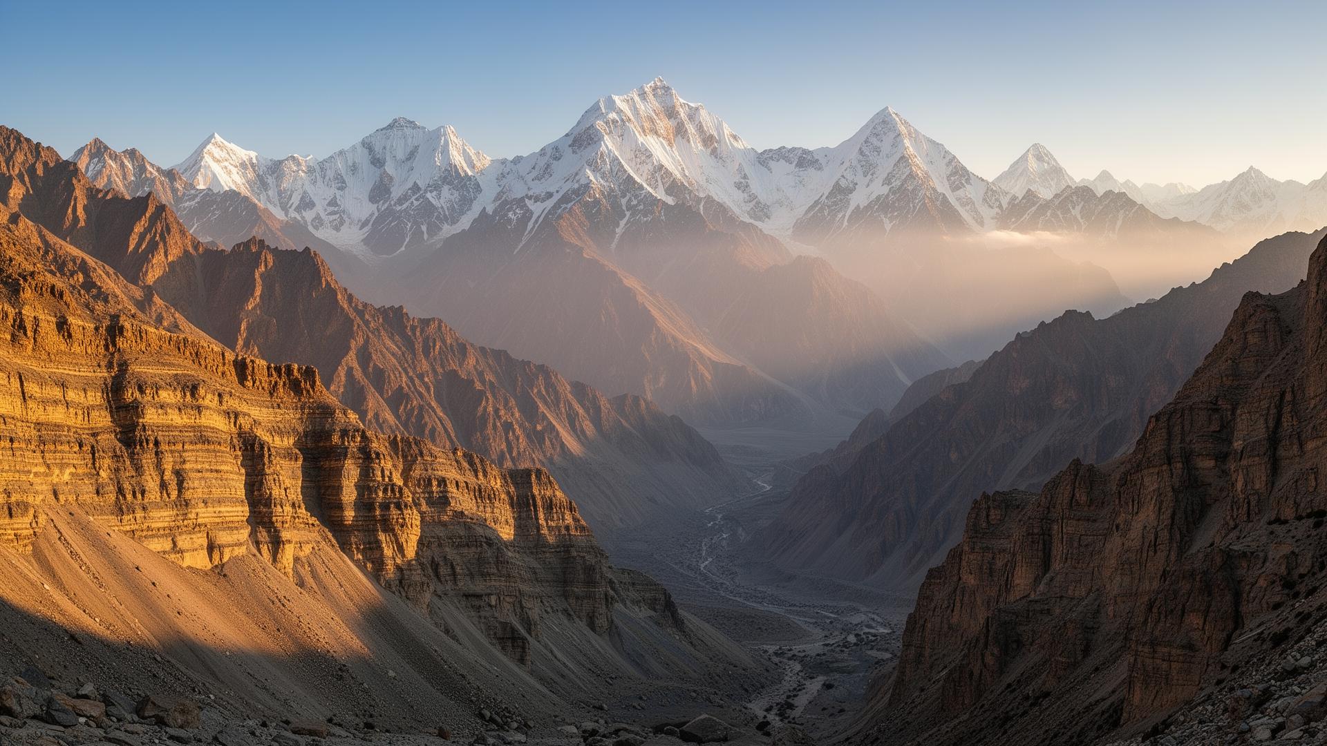
Baltoro Glacier, Concordia & K2

Glacier or glaciogenic feature

also Central Karakoram National Park

The Baltoro Glacier leads to Concordia, where the greatest concentration of high peaks on Earth — including K2 (8,611 m) — rises from the Miocene Baltoro granite batholith. The area lies within Central Karakoram National Park, Pakistan's largest protected area.

  • Miocene Baltoro leucogranite, a young Himalayan-type batholith
  • Concordia: four of the world's fourteen 8,000 m peaks within ~20 km
  • Central Karakoram National Park
ScenicScientific

Exposes

Erosion / retreat Details →

Deosai Plains

Distinctive erosional/structural landform or scenery

also Deosai National Park · Land of the Giants

One of the highest plateaus in the world (~4,100 m average), Deosai is a glaciated upland of granitic and metamorphic terrain between the Karakoram and the western Himalaya, protected as Deosai National Park for its Himalayan brown bear population and alpine flora.

  • Among the highest plateaus on Earth
  • Glaciated granite–gneiss terrain and periglacial landforms
  • Deosai National Park (Himalayan brown bear)
ScenicScientific
Stable Details →
Palaeozoic

Khunjerab Pass & National Park

Distinctive erosional/structural landform or scenery

also Khunjerab top

At 4,693 m the Khunjerab Pass is the highest paved border crossing in the world, cut across the Permian Karakoram succession (Gircha and Kundil formations). It lies within Khunjerab National Park, a high-altitude refuge for snow leopard and Marco Polo sheep.

  • Highest paved international border crossing on Earth
  • Permian Northern Karakoram section (Gircha–Kundil)
  • Khunjerab National Park high-alpine ecosystem
ScenicScientific
Palaeozoic

Passu Cones & Batura–Passu Glaciers

Glacier or glaciogenic feature

also Cathedral Ridge, Hunza

The serrated 'Passu Cones' are carved from steeply dipping Permian–Triassic Karakoram carbonates (Guhjal Dolomite) beside the Batura and Passu glaciers — two of the longest valley glaciers outside the polar regions — in one of the most photographed landscapes of upper Hunza.

  • Sawtooth peaks in folded Guhjal Dolomite / Gircha Formation
  • Batura Glacier (~57 km), a major surging glacier
  • Iconic Karakoram Highway viewpoint
ScenicScientific
Erosion / retreat Details →

Nanga Parbat Massif 1

Province →
Precambrian

Nanga Parbat–Haramosh Massif

Fault, suture or tectonic-boundary exposure

also Nanga Parbat syntaxis

The western Himalayan syntaxis, where Indian-plate gneiss is being exhumed faster than almost anywhere on Earth, driving the 8,126 m peak of Nanga Parbat. The massif exposes deep-crustal rocks and young (Pliocene–Recent) metamorphism and granites.

  • Among the fastest-exhuming crust on the planet
  • Indian-plate basement gneiss cored into a tectonic 'pop-up'
  • Ninth-highest mountain on Earth
ScientificScenic

Indo-Pakistan Shield 1

Province →
Precambrian

Nagarparkar Granite (Thar)

Exposed Precambrian basement / shield

also Nagar Parkar hills

Isolated granite hills rising from the Thar Desert at the far southeast of Pakistan expose the Neoproterozoic Nagarparkar (Malani-related) igneous complex — the country's window onto the exposed Indian shield basement — and host historic Jain temples cut into the rock.

  • Neoproterozoic Malani-affinity granite of the Indian shield
  • Pakistan's principal exposure of Precambrian basement at surface
  • Carved Jain temples and quarried ornamental granite
ScientificScenicCultural

Khyber–Nowshera Belt 2

Province →
Palaeozoic

Misri Banda Ordovician Quartzite

Notable fossil or trace-fossil locality

also Misri Banda trace-fossil locality

The type area of the Ordovician Misri Banda Quartzite, whose cross-bedded quartzites carry abundant Cruziana rugosa and Skolithos trace fossils — among the clearest Lower Palaeozoic ichnofossil assemblages in the Peshawar basin.

  • Type section of the Misri Banda Quartzite (Tremadoc–Llandeilo)
  • Cruziana rugosa and Skolithos trace fossils
  • Marks the Ordovician transgression over the Cambrian(?) Ambar Formation
ScientificEducational
Palaeozoic

Nowshera Devonian Reef

Notable fossil or trace-fossil locality

also Ghundai Sar / Nowshera reef complex

The Nowshera Formation preserves the only Devonian reef complex known in Pakistan — sandy dolomite and fossiliferous reef limestone dated by conodonts to the Early–early Late Devonian, giving the first firm Devonian ages south of the Main Karakoram Thrust.

  • Pakistan's only Devonian reef (stromatoporoid–coral) complex
  • Conodont-dated Lochkovian–Frasnian
  • Historically important for Peshawar-basin biostratigraphy
ScientificEducational
Quarrying Details →

Geosite selection is editorial. Every geological statement concerns the linked stratigraphic units, whose facts and citations are given on their unit pages. Coordinates are indicative and not surveyed; conservation notes name formally protected areas only where that status is well established. Suggest a site or a correction via Contribute.